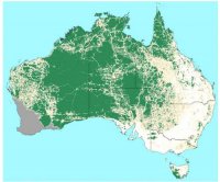
Australia is blessed with wild areas that remain natural and untouched by human kind. It eventually became apparent however, that these areas were being rapidly encroached upon and affirmative action was required by the government in order to protect the remaining wilderness. This responsibility was managed by the Australian Heritage Commission and their first challenge was to identify wilderness areas.
The NWI identified that the two key aspects of wilderness are  remoteness and naturalness. Defining those qualities is a challenge in its own right as it requires consideration of historical activities and agreement of the impacts on wilderness value of those activities. Beginning with Victoria, the Commission compiled base datasets to enable to determination of naturalness and remoteness and described each source in a metadata catalogue. Source data had to be cleaned and rationalised and then raster based processing in ArcInfo was used to overlay the data in order to determine wilderness quality.


