


Week 1
An introduction to GIS by Delphine Jasmin-Bélisle, young archaeologist currently intern at Spatial Consultants to learn the usefulness of GIS for Archaeological, Heritage Management and Community-based projects.
If you have reached this page during your exploration of Spatial Consultants’ services, this question is probably on your mind, and you are most certainly seeking answers in simple, clear words to give you a better grasp of GIS. As a newcomer to GIS technology, without any previous formal background in computer technologies, I have asked myself the same question and, probably in the same way as you, I am keen to discover how and if, GIS can be of use in tangible terms with time, money and expertise restrictions. I am also keen to explore the pitfalls of GIS technology, as no new science comes without its problems. It is keeping these questions in minds that I have started my research and readings, and in the following sections will try to answer them, in the most concrete and practical way possible.
How to use this page
I tried to make this article as flexible to suit your questions and needs. You may have only a few minutes and some simple questions you want answered, in which case I would recommend to have a look at the titles of each section, to find swiftly what you are looking for as I have tried to make the sections as self-contained as possible.
In the next few weeks, I will periodically add new sections as my understanding of GIS grows deeper (every new section will be dated to help you to find it more easily). Therefore it might be worth it to revisit this page from time to time to find further information.
Finally, if you seek a more personal and humoristic thread of my learning as I find out how to use GIS Open Source software, I recommend you keep a eye on my blog, Confessions of a GIS apprentice http://gisconfessions.blogspot.com/
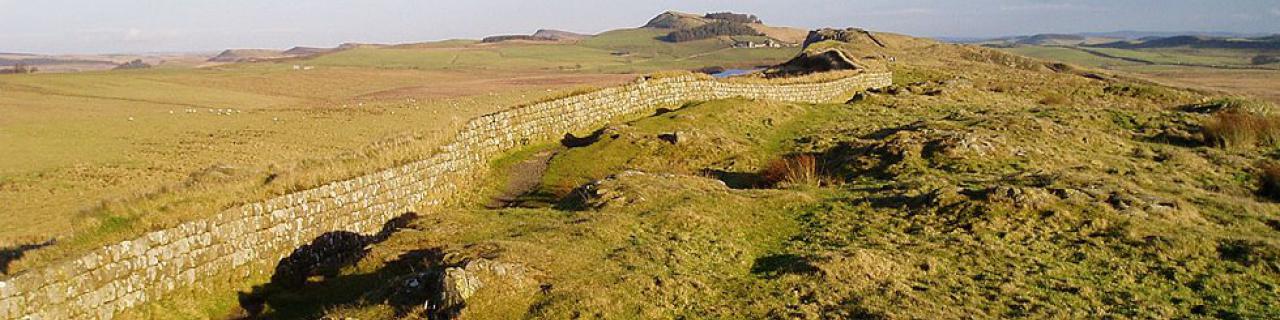
The power of maps: an historical introduction to GIS use
In 1854, cholera, a lethal infection, was striking Britain with not a soul knowing where the disease came from (at the time, it was believed that similarly to the Plague, cholera was due to polluted “bad” air). A London physician, Dr. John Snow, wary of these absurd theories, decided to place on a map of the city the various outbreaks of the sickness. Quickly he was able to trace correlations between the outbursts of the disease and infected water pumps, particularly the Broad Street pump in Soho. Using statistics drawn from the map of outbreaks to support his theory, he retraced the source up to a waterworks company who was acquiring its water from a sewage-polluted section of the Thames.
What is GIS technology?
As this short story demonstrates, maps utility goes far beyond the simple display of information. But what if you could combine the visual efficiency of a map to the immense powers of digital analysis and databases... Welcome to the World of GIS.
In our lives, most problems/projects, have a geographic component, (if fact it is even a difficult exercise to find something that cannot be mapped), GIS (Geographic Information Systems) technology combines geographical data (e.g. location), with other attributes and values (ethnic groups present, type of trees, number of occupants, risk of change, anything really!). It can store this information, analyse it and present it in different formats: maps, tables, animations, etc. GIS does not actually stand for a single tool but rather a wide range of systems capable of a wide range of tasks depending on the problem, whether it is the distribution of a selected phenomenon, the impact of a specific event, the relationship between two components (e.g. traffic and health problems) in a specific region, or many other types of problems/projects. The key that differentiates GIS from other analysis and map software is that it can process data from dissimilar sources: map, image, video, statistic, CAD, sensor, etc.
GIS visual displays enable easier and faster problem-solving, as it simplifies abstract figures and features to convey effectively information. It also helps to discover complex relationships which would not have been visible through texts or tables and facilitates lateral or creative thinking. Its data management capabilities enables organisations to reduce hand-based information, free staff to do more efficient tasks and most importantly enables to integrate and process enormous amounts of disparate data, which would be unfeasible manually. Finally its analysis capacities can offer experimentations impossible to do in the Real World, with time-space simulation, to see how components influence each other over time. In brief, GIS saves time, manpower and money through effective database inventories and facilitates decision-making and the communication of information.
Examples of GIS in our daily lives
Let’s use three examples to show how GIS is integrated in our daily lives. Mr. A is a truck driver. During his trips, he uses a SatNav or his computer to find the best way to reach his destination. As he is often in unknown locations, he also uses his computer or his iPhone to find the nearby Thai restaurants, as Mr. A is a fine diner.
Ms. B is what we could call a keen shopper, fan of vouchers and good offers; she has loyalty cards for all her favourite shops. However today she was out of luck, on her way to the best offers, her car broke down and she had to call for emergency services, they responded quickly and rescue arrived within 15 minutes.
Mr. C is a census analyst. He uses the information of the 2011 UK Census, to find which areas need a better allocation of funds and facilities. But to take his mind of work, he is also a keen diver – Mr. C lives in Cornwall you see – and is involved in a project to map the coral formation around Penzance and evaluate how harmful the pollution could be from the local maritime industry.
In these three cases, GIS is at the heart of the actions taken. Mr. A is the user of very common GIS applications, which answer simple questions, like the quickest route between two points or map facilities and indicate a selection following simple criteria, e.g. Thai Restaurants. These tools, e.g. AA planner, Satnav, Google map, are used daily by a great proportion of the population, who often are not even aware it is GIS.
In this example, Ms. B doesn’t use GIS tool s herself, but she unknowingly generates GIS data. Her loyalty cards generate “lifestyle data”, enabling the retailers to track her purchases and better evaluate the patterns and taste of shoppers in that area. This can help them to create a distribution network of vouchers, tailor the selection of products to follow the customer’s taste and even help predict the chance of success of a new shop in that area. Also when Ms. B’s car breaks down, the emergency services she calls use a GIS program to determine which mobile unit is the closest to her, with the right tools to offer support, to enable a quick response.
Of our three examples, Mr. C is probably the only one who knows the word “GIS”. As a census analyst, Mr. C converts the information acquired into anonymous blocks regrouped by neighbourhood; he will then use GIS complex analysis tools to find how this information can be used to improve decision-making in both national and local government. At home, Mr. C uses free Open Source GIS software to map the corals formations he recorded using a GPS. He then uses a GIS simulation tool, to forecast how different types and amount of pollution could affect the corals in the future.
These three examples are only very simple illustrations of some of the functions used by GIS, but they summarise some of the key aspects of GIS:
- used in a variety of fields, from national government to local environmental project, passing by commercial retailers
- used to solve a wide range of problems, from simple mapping to complex analysis of geographic and none-geographic (e.g. lifestyle information) data
- used every day by the majority of the population, consciously or not.
In practical terms, what can GIS do for you?
As it is mentioned in “What is GIS technology”, GIS is not a single software, but rather a range of tools which combine geographical, and non-geographical data into a powerful database, analysis and presentation program. This means that it is possible to use a tailored GIS tool for as simple or as complex program/project you want to solve. Whether you want to do a market research, manage your resources, inventory your assets, simulate how a phenomenon could affect a particular element through space-time, this and so much more is possible in GIS. If this technology was used more traditionally in the fields of government and environmental resources management, it has now extended to any field, from transportation logistics, to retailer’s marketing tool, archaeological or site managing tool (e.g. GIS technology is currently use to inventory and manage the building site of London 2012 Oympics, where a lot of information (material and man resources, building locations, etc.) is in constant movement and must be carefully managed to bring a successful development). Hopefully by now, you are already developing ideas of what GIS could do for you; otherwise you could also consult specialists like Spatial Consultants on how GIS could help improve your company/project. In the next few weeks I will integrate to this section a brief case-study which shall illustrate in further details how GIS can be used for your own profit.
Price Tag
So far, everything that had been said may lead you to think GIS is a complex and expensive technology, unreachable for small-medium businesses with limited financial means. But – luckily – this is where you are wrong!!
Certainly, in the past few decades, GIS was less accessible as the costs of hardware (powerful computers), software and data, were high and the options limited. In 2005, the GIS software industry accounted for £1.8 Billion in annual sales (these numbers do not include the sales in the data industry) and these numbers have just been climbing ever since. This led to the creations of a series of tailored program for the particular tool you need from GIS technology, available off-the-shelf and without a need for a super performing machine. Therefore it is possible to select a specialised product specific to your needs for lesser cost.
But there are even better – and cheaper!! – solutions now available. Recent years have seen the development of Open source software, i.e. software created by a community of users and developers worldwide, which are free, with the details of the program available so keen programmers can even modify, customize and improve the software for their own purpose. Thousands of companies and community-based projects have now opted for this free solution which, with the correct guidance, gives them the liberty and facility to have a project/program tailored to their needs at minimum cost.
No matter whether you choose software off-the-shelf or Open Source software, the key is to shop around and mostly importantly be informed. Specialist consultants will help you to make the best choice, tailored to your needs and budget, in order to avoid time and money loss.
The Pitfalls of GIS
(What you need to be careful about if you’re interested to do a project in GIS)
Cost: We have mentioned it in the “Price Tag” section, it is easy to overspend in GIS technology. Not only the software and hardware (computer) can become an expense, the data can also be high-priced, as some companies made data production their specialisation. In the 1990s many local governments in USA, suffered great overspending over GIS technology, with data acquisition, hardware and software purchases and could still be left with inefficient system due to bad choices leading to incompatibilities between software. But, things are changing, data and Open Source GIS software are now available for free in many instances and informed choices can leave you with a very productive GIS system, for very little money.
Right problem: As silly as this may sound, it is important to decide the right problem/question you want to solve. For example, will the sales of fair-trade bananas in an area, really affect the number of iPods sold in that same area? Doubtful... Geographical data does not automatically correlate in cause-effect in the real world. No matter how good your software or your operators are, no amount of scientific ingenuity can salvage a problem/question which was not carefully planned at the start. Therefore, it is worth spending extra time and means in the thinking of what you want to achieve and the data which will help you reach that goal, rather than running ahead too fast, and finish with an opaque or inaccurate representation, which does not bring anything new.
Right data: The key issue with data is most certainly its accuracy, but also the scale and the criteria and dividers of this data can also lead to problems. With GIS technology becoming more and more accessible it is unfortunate, but not surprising to see flawed or even manipulated results (not all maps produced in GIS have equal accuracy). Certainly a great deal of these mistakes is to do with the acquisition of data, particularly in the instance where the data is collected specifically for the project/business, rather than originating from a reliable source. A second reason for inaccurate map is the way the data is grouped, the scale or even the choice of the data for the problem, which if inaccurately chosen can lead to hide underlying distribution, the omission of minorities, etc. Simple checks can be made to avoid these difficulties, and skilled operators can soon make sure that accurate, well-managed data give the expected successful results.
For all of these problems, information leads to the best solution. Specialists can help you to make the right choices, at the right cost, and identify the best way to use GIS within your company/project. More information on what this company can do for you (which hopefully should be a little bit clearer now that you know more about GIS) can be found on their homepage.