The GIS Hub project had demonstrated the benefits of a united approach to spatial data management within the City of Portland, USA. Maintaining spatial data to a quality that would support a broader range of uses, however, required significant improvements to the data maintenace and access infrastructure:
- Data integrity rules needed to be automated to improve consistency and efficiency;
- Maintenance costs needed to be reduced;
- Data needed to be accessed by multiple channels including web and potentially mobile;
- Data currency needed to be improved so the updates were made available quickly;
- Data auditing and security controls needed to be strengthened.
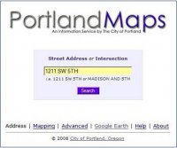
The EGH (Enterprise GIS Hub) project built upon the progress made by the  GIS Hub to consolidate all the City disparate GIS systems and data, referred to as the “rich mix of technology”, into a single shared Enterprise GIS data warehouse for all GIS related data in the City of Portland. The project then went further to develop the “Core” rule based GIS data maintenance tools using ArcGIS to maintain the City’s GIS layers while enforcing data quality standards of the Enterprise data models. The maintenance environments of each bureau were integrated with the Hub such that individual data changes were replicated directly to the Hub as they were approved. Finally, a centralized Web infrastructure was developed by CGIS to provide GIS web services to Citizens, Customers and City staff.


