Case studies provide real world examples of where Spatial Consultants staff have applied GIS based technologies and practices to solve business challenges.
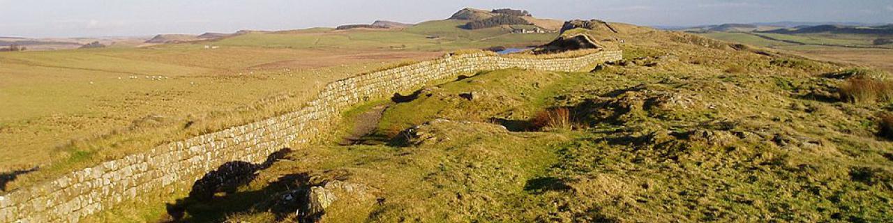
TfL manage the integrated transporation system for the area of greater London. This is an enormous remit covering the underground, buses, trams, overground trains, ferries, taxis, walking, cycling and congestion charging, as well as road asset maintenance, traffic movement and parking enforcement on certain routes. All operations generate and rely upon large volumes of geographically referenced information - which is not always as accessible as it could be. With demand for transport predicated to grow and the Olympic Games around the corner, TfL need to improve capacity and service quality. TfL is made up from several business units which have separate histories, practices and technologies; the operation of this multimodal transportation system requires integration of business areas, as well as their data and systems.
Solution Overview:
TfL are developing a concept called the Geospatial Enterprise Service Platform (ESP) in order to create a shared service model around its key technology and functional capabilities. The Geospatial ESP is designed to provide a complete set of centrally hosted, discrete GIS capabilities across the entire application stack, including spatial data storage, integration, analysis, visualisation, management and dissemination. The capabilities are designed to exhibit infrastructural characteristics such as high availability, scalability reliability, performance and security and will be available to any business application as Web Services. The ESP concept addresses the business/commercial, organisational, governance, people and process aspects that need to be in place to build, deliver and support the services.
The Geospatial ESP will be one of a number of Enterprise Service Platforms within the TfL IT Strategy which are being designed to consolidate key application functions and to enable the development of integrated (rather than duplicated) applications and workflows. The objective of the ESP framework is to enable TfL to move away from creating silo business applications and start thinking in terms of shared services in order to deliver the best ROI for IT investments to enable business units to deliver world class transportation services.
East Midlands Electricity (now e.on) is one of the UK's leading Distribution Asset Managers, responsible for providing a reliable electricity supply to customers across an area totaling 16,000 km², serving 2.3 million customers through a distribution network that has 24,009 km of overhead line and over 44,000 km of underground cable. Deregulation of the electricity supply industry and new legal KPIs required EME to transform the way it managed the distribution network to improve service levels to customers whilst reducing operating costs.
Solution Overview:
EME adopted GE Smallworld GIS as the platform for the distribution management system. A series of customised applications were developed to capture existing enfineering data from physical media into digital form and to manage the data and operations into the future. A very rich Object Oriented data model was developed encapsulating asset attributes and behavior for all network components - to the extent that predictive simulation modelling could be performed to identify faults on the nertwork. Models enable network data to be represented in a variety of user centric ways such as true geoghraphic for field staff, schematic for control room operations, and geo-schematic for drivers. The system was integrated with network design, inspection & maintenance, outage management, SCADA, and customer information systems. Smallworld spatial replication enables data from all regional offices to be accessed as a complete set. Regional offices provided strong support in adopting the standards of the corporate asset data model, symbology and maps/plans.
The Canadian province of British Columbia covers an enormous area which is generally rich in natural resources and natural beauty. Interestingly, the vast majority of that land is owned by the Crown and is therefore administered by the BC government. A range of departments thus considers applications for permits to perform a bewildering array of activities within the forests, on the ground and beneath the surface of the land. Some of these activities are exclusive, e.g. open cast mining, whereas many others can occur in the same area at the same time, e.g. forestry and fishing. It is the job of each department to assess new permit applications and to determine if there is any reason why they should not be granted, or if any restrictions should be placed upon them. This process could take years in some cases to complete and this delay was recognised as being harmful to business - it simply had to be speeded up and be made more transparent.
Solution Overview:
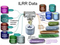
ILRR Data
The BC government recognised very quickly that businesses who were considering an operation within British Columbia needed to be able to submit an application for a permit with some degree of confidence that it would be successful and that they would know the result within a reasonble time frame. The key was seen as making information about permits available online so that applicants could determine what activities were taking place in a given area and therefore be able to assess the likelehood of their own application being successful.
The approach required changes to provincial legislation and the formation of a new body to administer the integrated Provincial registry. Existing land ownership and permit data needed to be enhanced in some cases to ensure that each permit could be associated with a location/area and a time window. Data was then published from existing permitting systems into a central registry - the Integrated Land and Resource Registry (ILRR) from where key information could be accessed online by government staff and the general public.