Delivering Positional Advantage


Case studies
Case studies provide real world examples of where Spatial Consultants staff have applied GIS based technologies and practices to solve business challenges.
Client - RWE Thames Water
The Challenge:
Driven by the changes introduced by OS MasterMap for base mapping, Thames Water needed to ensure that all their GIS based systems were able to work seamlessly with the new positional reference data. This prompted a review of GIS across the estate to adopt modern approaches to data management and systems integration in order to improve the performance of the operational, engineering and asset management functions of the organisation. The project had the following objectives:
- Improve data confidence/quality
- Provide an enterprise perspective
- Support asset investment and strategy objectives
- Support goal to become a UK leader in asset planning and regulator management
- Adopt MasterMap for positional reference
- Reduce GIS cost of ownership
Solution Overview:
Thames Water sought to rationalise the complex mix of geospatial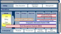 technologies and applications, which had evolved over time, to provide an integrated asset repository that would present a single source of truth. The solution involved the creation of an asset information model to present an holistic picture of the state and history of each asset in the water distribution and treatment networks. The repository is an enterprise resource accessible through industry standard query and data exchange protocols and supports multiple GIS platforms including ESRI, Autodesk and Oracle.
Client - Australian Heritage Commission
The Challenge:
Australia is blessed with wild areas that remain natural and untouched by human kind. It eventually became apparent however, that these areas were being rapidly encroached upon and affirmative action was required by the government in order to protect the remaining wilderness. This responsibility was managed by the Australian Heritage Commission and their first challenge was to identify wilderness areas.
Solution Overview:
The NWI identified that the two key aspects of wilderness are  remoteness and naturalness. Defining those qualities is a challenge in its own right as it requires consideration of historical activities and agreement of the impacts on wilderness value of those activities. Beginning with Victoria, the Commission compiled base datasets to enable to determination of naturalness and remoteness and described each source in a metadata catalogue. Source data had to be cleaned and rationalised and then raster based processing in ArcInfo was used to overlay the data in order to determine wilderness quality.
The Challenge:
Ontario is a large Canadian province with abundant natural resources, including significant timber reserves. Logging of the natural forests reached a point where a public out cry at Temagami forced a rethink on timber management and the Ontario government adopted a more holistic approach to forest management. Managing the forest (rather than timber alone) required that the government understand much more about the forests. An integrated approach was needed that considered all forest interests.
Solution Overview:
The Ontario Ministry of Natural Resources (OMNR) embarked on a program of integrated forestry management built around a central repository of information about all things related to the forest. This included trees, water bodies, settlements, roads, animal habitats and migration routes, native interests, historical sites, etc. - effectively all things of value within the forest. This was enormous data modelling and data capture exercise. The Natural Resource and Values Information System (NRVIS) was developed as a central geospatial database to collect and manage this information during the course of government and business activities. Resource companies had access to this data in the preparation of planning applications and associated management plans. The same information was made available during the public consultation process to provide assurance that all forest interests were openly considered.